


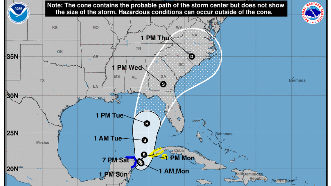


(CMR) Tropical Depression 10 is expected to make landfall in Florida as Hurricane Idalia by the middle of this week after forming in the Gulf of Mexico, according to the National Weather Service.
Parts of Cuba and Mexico have been put under tropical storm warnings and watches. The depression is about 70 miles east-northeast of Cozumel, Mexico, with maximum sustained winds at 30 mph.
The current forecast track has the storm strengthening into Tropical Storm Idalia by Monday and Hurricane Idalia by Tuesday.
According to the National Hurricane Center, at 1 am CDT (0600 UTC), the center of Tropical Depression Ten was located near latitude 20.7 North, longitude 86.8 West. The depression is moving toward the southwest near 5 mph (7 km/h), and it is likely to meander near the Yucatan Channel through early Monday. A faster motion toward the north or north-northeast is expected later on Monday, bringing the system over the eastern Gulf of Mexico.
Maximum sustained winds remain near 35 mph (55 km/h) with higher gusts. Additional strengthening is forecast during the next few days. The depression is expected to become a tropical storm later today and a hurricane by Tuesday.
A Weatherflow station on Cozumel reported a sustained wind of 36 mph (57 km/h) and a wind gust of 48 mph (78 km/h).
The estimated minimum central pressure is 1001 mb (29.56 inches) based on surface observations from Cozumel and Playa del Carmen.
- Fascinated
- Happy
- Sad
- Angry
- Bored
- Afraid


