


(CMR) The Cayman Islands National Weather Service clarified this morning that Grand Cayman remains under a hurricane warning and a tropical storm watch is in place for Cayman Brac and Little Cayman. An initial lifting of the storm watch for the sister islands at around 10:00 am this morning was reinstated about one hour later.
Cayman started to experience some squally weather from the other bands of the storm shortly before midday.

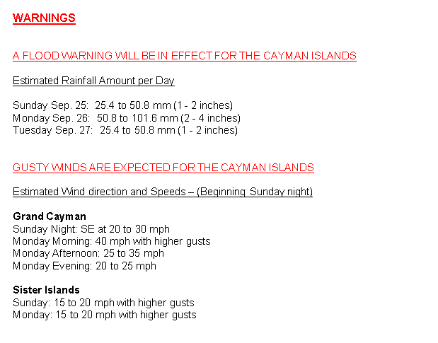
A hurricane warning means that hurricane-force winds are likely within 36 hours. Marine warnings remain in effect particularly for the southern coast.
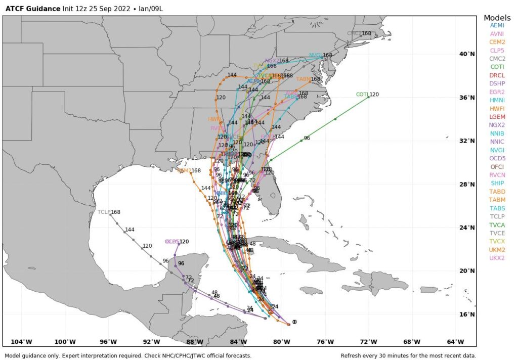
As of 10 am, Tropical Storm Ian was located at 15.2N and 79.8W of about 300 miles SSE of Grand Cayman with maximum sustained winds of 50 mph. Tropical Storm Ian is moving towards the WNW at 14 mph with a minimum central pressure of 1001mb / 29.59 inches.
If the storm continues on its current path, Grand Cayman can expect overcast skies with widespread thunderstorms are expected from Sunday evening with tropical storm conditions by early Monday morning as the system nears the Cayman Islands. Extremely rough seas accompanied by storm surge are also expected. Swells generated by Ian will spread into the Cayman area later today.
The sister islands can expect overcast skies along with widespread thunderstorms are expected from Sunday evening as Tropical Storm Ian moves closer to the Cayman Islands. Extremely rough seas along with swells and storm surges are also expected. Given the adjustments to forecast track, the possibility for storm force winds is lower for the Sister Islands.
 Interests in Florida are starting to monitor the track of the storm, which is anticipated to impact them in the coming days.
Floridians are being warned that
- Fascinated
- Happy
- Sad
- Angry
- Bored
- Afraid


