


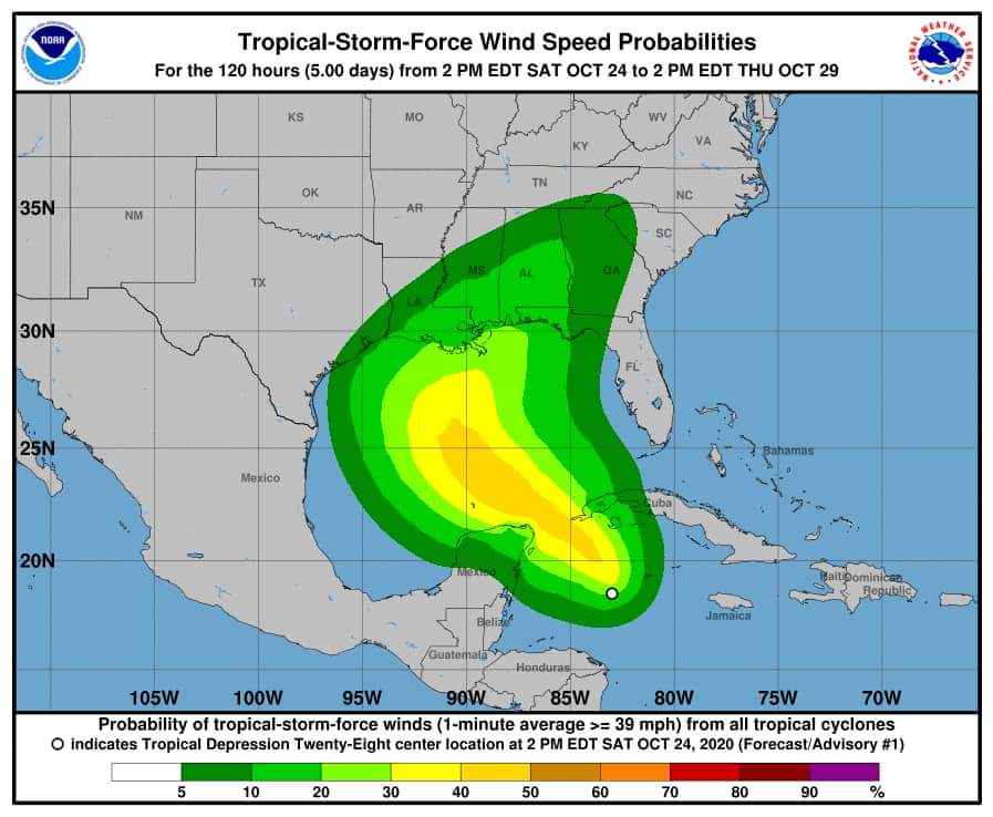


(CMR) The National Hurricane Center is closely monitoring Tropical Depression 28, located due west of Grand Cayman. The system has been stationary for nearly 48 hours causing scattered showers and isolated thunderstorms for the Cayman Islands.
Showers are expected to become heavy at times and a flood warning remains in effect for the Cayman Islands for low lying areas.
Radar images show widely scattered showers in and around the Cayman area which are moving towards the northwest. This system is expected to become better organized and could develop into TS Zeta.
Forecasted weather includes daytime temperatures that will rise to the upper 80’s °F. Winds will be south to southeast 10 to 15 knots with higher gusts in and around heavy showers. Seas will be slight to moderate with wave heights of 2 to 4 feet and may become choppy in and around heavy showers.
Overnight temperatures will fall to the mid 70’s °F. Winds will be south to southeast 10 to 15 knots with higher gusts in and around heavy showers. Seas will be slight with wave heights of 1 to 3 feet and may become choppy in and around heavy showers.
Boats and vessels on the west side of Cayman may expect larger swells than usual in the coming days.
As of 4:00 p.m. Cayman time the system's details were:
5:00 PM EDT Sat Oct 24
Location: 18.7°N 83.0°W
Moving: NNW at 2 mph
Min pressure: 1005 mb
Max sustained: 30 mph
- Fascinated
- Happy
- Sad
- Angry
- Bored
- Afraid


