


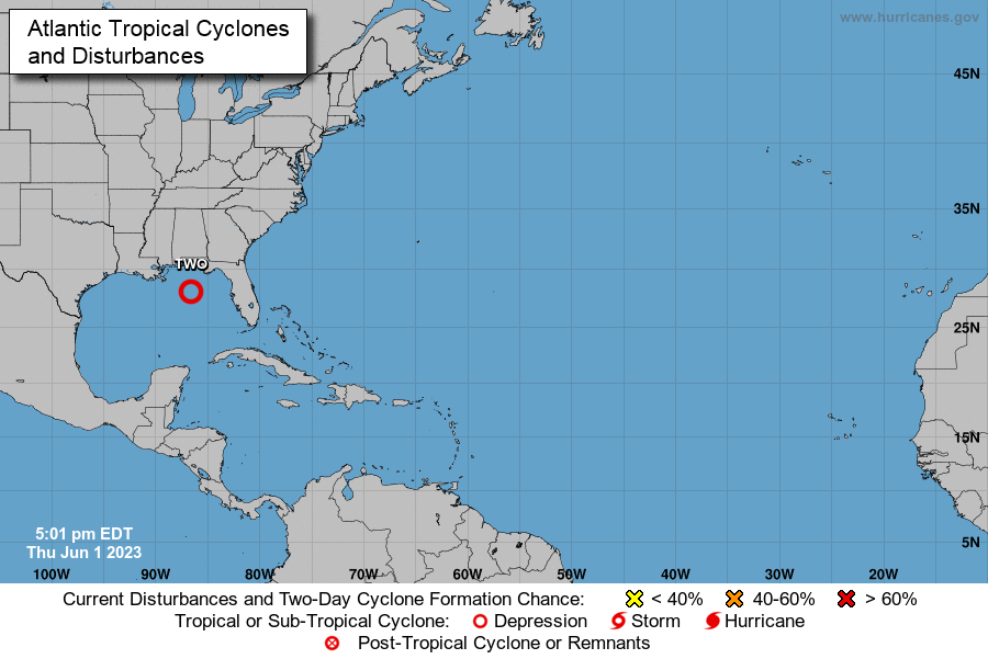


(CMR) As the Atlantic Hurricane Season starts, Tropical Depression 2 has developed in the Gulf of Mexico and is expected to travel southward in less favorable conditions for development.
According to the National Oceanic and Atmospheric Administration, at 4 PM CDT, the center of Tropical Depression Two was located near latitude 28.0 North and longitude 86.6 West. The depression is moving toward the west-northwest near 2 mph (4 km/h). A motion to the south is expected to begin by Friday with gradually increasing forward speed.
Maximum sustained winds are near 35 mph (55 km/h) with higher gusts. Some modest intensification is forecast, and the depression could become a tropical storm tonight or tomorrow. However, the system should begin to weaken by Friday night and degenerate into a remnant low by Saturday.
The estimated minimum central pressure is 1007 mb (29.74 inches). The NOAA reported sustained winds of 36 mph (57 km/h) with a gust of 40 mph (65 km/h).
Meantime, cloudiness and scattered showers are expected to continue for the next 24 to 36 hours in the Cayman Islands due to an interaction between the weak pressure gradient at the surface and an upper-level trough near western Honduras. Radar images show scattered showers in and around the Cayman area drifting towards the northeast.
CIG agencies complete successful hurricane preparedness exercise
- Fascinated
- Happy
- Sad
- Angry
- Bored
- Afraid


